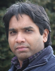
Dr. Chandi Witharana
Assistant Professor in Residence
Department of Natural Resources & the Environment
Dr. Chandi Witharana is an Assistant Professor in Residence in the Department of Natural Resources and the Environment at UConn’s College of Agriculture, Health and Natural Resources (CAHNR). He is the Director of UConn’s Remote Sensing and Geospatial Data Analytics Online Graduate Certificate. Dr. Witharana is also an affiliated faculty of Eversource Energy Center and the Institute for the Brain and Cognitive Sciences at UConn. He is a member of American Society for Photogrammetry and Remote Sensing and the American Geophysical Union. Dr. Witharana is the Director of ConnecticutView at UConn. He earned a PhD in Remote Sensing and an MS in GIScience at the University of Connecticut, and a BSc in Geology at the University of Peradeniya, Sri Lanka. Prior to joining the UConn faculty, he was a Post-doctoral Research Associate at the SUNY Stony Brook. Dr. Witharana was a Geospatial Analyst at the United Nations Office for the Coordination of Humanitarian Affairs. He conducts interdisciplinary remote sensing research speaking to the transformational uses of earth observation technology in environmental, industrial, and humanitarian applications.
Email: chandi.witharana@uconn.edu

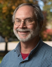
Dr. Thomas H. Meyer
Professor
Department of Natural Resources & the Environment
Dr. Thomas H. Meyer is a professor in the Department of Natural Resources and the Environment at UConn’s College of Agriculture, Health and Natural Resources (CAHNR). Dr. Meyer is a member of the American Society of Civil Engineers, American Association for Geodetic Surveying (Fellow and Director), and the American Geophysical Union. He is a past president (2006-2007) of the Geomatics Society of New England (was the New England Section ACSM) and a member of the editorial board of the Journal of Surveying Engineering. Dr. Meyer earned his PhD from Texas A&M University (College Station, 1998) where he was a research associate in the Mapping Sciences Laboratory. During his tenure at UConn, he has taught geomatics courses in geographic information science, geodesy, digital terrain modeling, global navigation satellite system surveying at the graduate and undergraduate levels. Dr. Meyer has authored an undergraduate-level geodesy textbook, numerous peer-reviewed papers about surveying and mapping, and teaches professional education seminars for surveyors throughout New England and the United States.
Email: thomas.meyer@uconn.edu

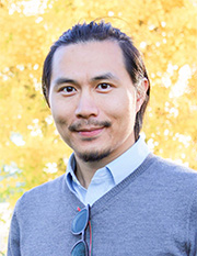
Zhe Zhu
Assistant Professor
Department of Natural Resources & the Environment
Dr. Zhe Zhu is an Assistant Professor in the Department of Natural Resources and the Environment at UConn’s College of Agriculture, Health and Natural Resources (CAHNR). Dr. Zhu is a member of the USGS-NASA Landsat Science Team and CalVal Center of Excellence (ECCOE) Science Interface Panel. Dr. Zhu is also the Associate Editor of Remote Sensing of Environment, Science of Remote Sensing, and on the Editorial Board of PeerJ and Remote Sensing. Dr. Zhu earned a PhD in Geography at Boston University, and a BE in Remote Sensing and Photogrammetry at Wuhan University. Prior to joining the faculty at UConn, Dr. Zhu worked as a Post-doctoral Research Associate at Boston University, Land Change Scientist at Earth Resources Observation and Science Center, Sioux Falls, and Assistant Professor at Texas Tech University, Lubbock. His research addresses remote sensing of land cover/land use, clouds, forest, urban, change detection, and time series analysis.
Email: zhe@uconn.edu